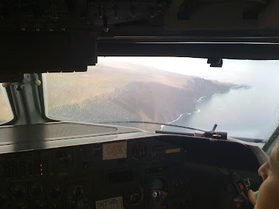
Dispatching can be a challenge. Even on good days. But when weather sets in, it's a whole new dynamic.
 This is what the weather normally looks like around here, but as shown in the SA above, things were about to get wetter!
On the 15th of Dec, This is what The North Pacific Surface Analysis was looking like. A long Low Pressure System extending from around Midway Island in the Pacific Northwest all the way across the Central Pacific and over into CONUS.

On Sunday morning the 19th of Dec this is what we came to work to. The beginning of 48 hours of weather to contend with (Our shift in dispatch is 9 hours). I myself actually look forward to days like this, it's because we rarely get them. Heavy rains mainly over Kauai to the west, Oahu and Western Molokai in the east. This shot of Doppler from weatherunderground.com show the cells in the area and intensity of moisture in the clouds. Upper level winds were light, but movement was from the WSW (West Southwest) direction.

On the ramp, rain gear is the uniform of the day as the weather makes the early morning preflights for the crews a fun one. Winds with the associated system was light and variable, so this caused having with visibility and ceilings. The wind wasn't there to keep the moisture moving so everything just "sat" around.
Later in the morning, visibility dropped to as low as 1/4 mile with +SHRA (heavy rain showers)and alot of TS (thunderstorms) in EMBD CB's (Embedded Cumulonimbus Nimbus clouds) here in HNL. We held flights going into MKK due to visibility was nearly zero. And LNY was slowly losing it's battle with the weather. Myself and the other dispatcher kept on updating the weather as quickly as it was being amended by the National Weather Service (NWS) and kept the crew well informed.
Now we know it was bad when HNL goes down below and alternates are required for the flights to return. Fuel loads were all increased for all flight outbound from HNL and inbound. By some luck when our flights were legal to depart, they all made it into their destinations on the first shot. No missed approaches occurred.
Due to the instability of the atmosphere over the Hawaiian Islands, we are looking at more continued wet weather into the Christmas weekend as another front approaches from the west.

In the mean time, it's back to blue skies and sunny weather...
...for now!!!


